Hurricane Melissa 2025
My personal selection of satellite frames and key moments from Hurricane Melissa — all manually captured in real time on an iPhone.
The slideshow below is fully interactive: click through the frames or use the thumbnails to jump directly to specific moments.
I am not a trained meteorologist, just someone with a deep fascination for weather
and extreme atmospheric events, and acted based on my own intuition and observations.
Every description in this project was created frame-by-frame with the assistance of AI
while the storm unfolded.
During Melissa’s closest approach I had up to twelve live webcams open simultaneously and captured everything directly on my phone.
A special thank-you goes to Jeff Piotrowski for his exceptional on-site coverage in Jamaica — I followed his livestream from Northern Germany throughout the event, which added an invaluable real-time perspective.
These are my best screen captures. I can provide additional imagery if it is helpful for further research or internal reference.
Love goes out to all the Jamaican people and to everyone who had been in the pathway of Melissa 2025.
I wish you all the support and protection you can possibly receive.
Notes & Setup
• Data Source: NOAA/STAR GOES-19 - GEOCOLOR
• Satellite & Product:
GOES-19 Advanced Baseline Imager (ABI) – Geocolor Composite (derived from Bands 2, 7 and 13).
The Geocolor product merges true-color daytime imagery with infrared nighttime detection, allowing continuous monitoring of storm morphology even in total darkness.
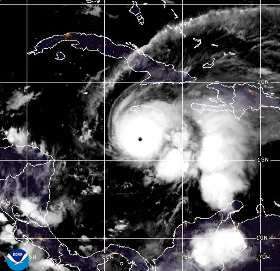
• Timeframe: 10/27/2025 06:40Z – Peak-Phase rund um Minimum Central Pressure / Maximum Sustained Winds
• Description:
This image captures Hurricane Melissa during nighttime rapid intensification.
A flawlessly defined eye sits within an expansive central dense overcast (CDO) exhibiting exceptional symmetry.
The bright white core corresponds to deep, vertically aligned convection, while the surrounding cirrus canopy reveals high-altitude outflow extending radially outward.
City lights from Jamaica and Hispaniola remain faintly visible through thin cirrus layers, emphasizing the storm’s proximity to land.
Bonus: Full Research Collage
As an additional reference, I created a high-resolution collage that combines multiple key frames and app views into one large overview image (approx. 8000×4000 px, transparent background, pure iPhone screenshots).
The collage can be opened in a separate tab due to its file size.
© len9one1.